Multi-constellation positioning
Uses multi-constellation, multi-frequency observations to improve positioning availability in challenging environments.

Home / Handheld GNSS RTK Receiver
Handheld GNSS RTK ReceiverA portable receiver for survey, inspection and mobile operations, combining multi-constellation positioning, RTK fixed solutions, field data collection and real-time data return.
| Item | Details |
|---|---|
| Product type | Handheld GNSS RTK Receiver |
| Positioning method | Multi-constellation, multi-frequency positioning |
| RTK capability | RTK fixed solutions supported |
| Data capability | Field data collection and real-time data return |
| Protection | IP67 |
| Communication and interfaces | Contact sales |
| Battery, dimensions and weight | Contact sales |
| Project adaptation | Selection, integration and field application support; scope confirmed with sales |
Uses multi-constellation, multi-frequency observations to improve positioning availability in challenging environments.
Supports RTK fixed solutions for high-precision positioning in mobile operations.
Organizes field data collection and real-time data return in one workflow.
IP67 protection for extended outdoor operations.
Delivery configuration can be confirmed against the industry workflow and application.
Selection communication, integration coordination and project support are available.
Both are handheld GNSS positioning receivers in the same family - choose by accuracy requirement and deployment style.
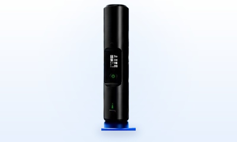
A portable multi-frequency positioning terminal for personnel and vehicle positioning management, field survey and patrol. It supports BDS / GPS / GLONASS / GALILEO multi-frequency positioning with NTRIP differential input and real-time data return, an OLED display with key operation, and an IP67-rated body suited to body-worn and portable field use.
| Category | Handheld GNSS positioning receiver |
| Positioning | BDS / GPS / GLONASS / GALILEO, multi-frequency |
| Update rate | Up to 5 / 10 / 20 Hz |
| Communication | 4G data transfer + MQTT + NTRIP + dual-mode Bluetooth (classic + BLE) |
| Display & UI | OLED display + key operation for device and positioning status |
| Protection & power | IP67; USB Type-C 5V/2A; battery and runtime details in the datasheet |
| Deployment | Phone add-on module, body-worn, vehicle roof, pole mount |
| Typical use | Personnel and vehicle positioning management, field survey, patrol, security and engineering recon |
A centimetre-level RTK handheld terminal for survey, inspection and mobile operations. It delivers BDS-3 all-constellation multi-frequency resolution with NTRIP CORS support, combining RTK fixed solutions, field data collection and real-time data return in one workflow, with an ISP high-brightness screen showing position, satellites, battery and network status plus multi-function key and voice prompts.
| Category | Handheld GNSS positioning receiver |
| Positioning | All-constellation cm-level RTK, NTRIP CORS supported, fix convergence typically <10s |
| Constellations | BDS-3 / GPS / GLONASS / GALILEO / QZSS / SBAS |
| Update rate | 1-20 Hz configurable, 10 Hz default |
| Communication | 4G global (domestic / overseas versions) + Bluetooth 5.1 dual mode |
| Display & UI | ISP high-brightness screen (position, satellites, battery, network) + multi-function key + voice prompts |
| Protection & power | IP67, 2 m drop, 4000 mAh, RTK runtime ≥20 h, USB Type-C 5V/2A |
| Deployment | Handheld survey, pole mount, safety-belt clip, helmet mount |
| Typical use | Engineering survey, land resources, power and water inspection, pipelines and railway, GIS collection |
The built-in helical antenna is fully upgraded and combined with all-constellation multi-frequency solving, lifting the RTK fix rate by 40% for more stable fixes in demanding environments.
A 4000mAh battery keeps the receiver running through full-day field shifts.
Upgraded from a low-power OLED panel to a high-definition ISP LCD colour screen for clear, true-to-life readings in bright sunlight.
Supports a wide 5-13V charging input range with 18V surge protection for more power scenarios.
Ships with the H13 unit, Type-C cable, 5V2A adapter, wrist strap and user manual.
Accuracy upgrade, 72H+ standby and industrial-grade build for professional surveying and mobile operations.
| Item | H13 (new generation) | H11 (first generation) |
|---|---|---|
| Satellite positioning | BDS-3 full constellation, GPS, GLONASS, GALILEO, QZSS (five systems) | BDS, GPS, GLONASS, GALILEO (four systems) |
| Differential positioning | RTCM2.3, RTCM3.x, CMR | NTRIP |
| SIM card | China edition: built-in eSIM plus external Nano-SIM; global edition: external Nano-SIM only | External Nano-SIM |
| Battery capacity | 4000mAh | 3300mAh |
| Weight | 140.5g | 104g |
| Body material | VO flame-retardant ABS+PC composite with double-sided anti-slip texture | ABS |
| Display | 28x13.5mm ISP high-definition display | OLED display |
| Power key | Single multi-function power key (long press / short press / double press) | Power key |
| Voice broadcast | Full status voice broadcast and remote text-to-speech broadcast | TTS voice broadcast |
| Communication protocols | USB / Bluetooth NMEA0183 plus TCP/HTTP/MQTT/JT/T808-2013 (JSON) | TCP/HTTP, HTTPS/MQTT, MQTTS/JT808 (JSON) |
| Remote management | 4G remote OTA, remote parameter configuration, remote status query, Bluetooth 5.1 wireless maintenance | Remote configuration, OTA upgrade, Bluetooth app configuration |
Both models share the same configuration tool and data protocols (NMEA0183 / JSON / MQTT / JT/T808), so existing H11 deployments can migrate to H13 smoothly. Final parameters are subject to the model datasheet and commercial confirmation.
Start from the job, not the datasheet. Survey and stakeout work needs centimetre-level RTK fixes, fast initialisation and long battery life, while pipeline inspection, municipal and utility data collection depend more on one-hand operation, 4G reporting and rugged protection. The YUEETEK handheld series covers both ends of that range with the H13 and H11 terminals.
Compare both models on the same dimensions: constellations and bands (BeiDou / GPS / GLONASS / Galileo multi-frequency solving), RTK initialisation time and fix rate, communications (4G, Bluetooth, MEMS), display and interaction, battery capacity and IP67 protection. The item-by-item differences are listed in Handheld RTK Selection: H13 vs H11 Upgrade Path.
Before deployment, review the Product Selection Guide, the field setup notes in Installation and Pole Height Setup and the full handheld GNSS RTK receiver datasheet (PDF). Building your own terminal? Compare the customizable RTK module PCBA and high-precision antenna systems, or contact us for project selection and pricing.
Click any image to inspect specifications, product details and application scenes.
For handheld GNSS RTK receivers, “centimetre-level” is a solution class, not a single number that applies to every site. Acceptance should separate horizontal and vertical errors, confirm that the receiver is holding an RTK fixed solution, and preserve the raw field records used for the decision.
| Check | What it means | How to validate |
|---|---|---|
| Published accuracy | YUEETEK handheld receivers support multi-constellation, multi-frequency solving and centimetre-level RTK fixed solutions. The high-precision antenna phase centre error is <±2 mm. | Use the datasheet, configuration list and project technical agreement for the selected product; do not mix figures across product lines. |
| Horizontal accuracy | Depends on correction quality, baseline, satellite geometry, multipath and pole verticality. | At a known point, hold a fixed solution and repeat observations; record horizontal deviations, fix rate and observation time. |
| Vertical accuracy | Evaluate separately from horizontal accuracy; height datum, coordinate transformation, sky view and multipath all matter. | Set a separate vertical threshold and verify the coordinate system and height datum before judging results. |
| Solution status | Float solutions or long correction ages must not be accepted as fixed-solution accuracy. | Confirm fixed status, correction continuity and complete logs before calculating accuracy statistics. |
Field validation in three steps: (1) use an open test point and confirm coordinates, datum and pole height; (2) collect at least three rounds at different times while recording fixed status; (3) judge against the project threshold and investigate corrections, multipath, pole height or coordinate conversion if results exceed it. Keep the raw record instead of adjusting it after the test.
Choose the terminal by workflow and accuracy requirement in the product selection guide, compare H13 and H11, review H13 vs H11 selection and pole-height setup, or download the handheld GNSS RTK receiver datasheet.